
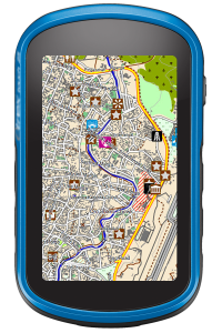
Our topographic vector maps show you all the details you need in the remote areas. All trails, unpaved roads and streets are fully routable, thousands of important points of interests are included, like camps, lodges, drinking water, tea shops etc. A detailed layer of contour lines at a high resolution distance of 20 meters, all minor and major peaks as well as hill shading (if supported by your software) show you the topographic details you need for orientation.
If you are interested in digitized historical paper maps, we have some amazing products in our portfolio as well. The paper maps used for the seamless digital raster maps were produced by the USSR military from around 1980 to 1990 and by the US Army Mapping Service (AMS) in 1957 and from around 1983 to 1988. We offer both sets in different resolutions and digitally enhanced with hill shading and an included (vector) overlay of digital contour lines.
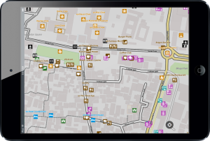
Topographic Vector Maps
Vector maps are perfect for navigation purposes like travelling by car, motorbike, mountain bike or trekking by foot. Our very detailed vector maps are available for Garmin® GPS Devices as well as for Smartphones/Tablets (Android®, iOS®, Windows®) and Desktop PCs (Windows®, MacOS®).
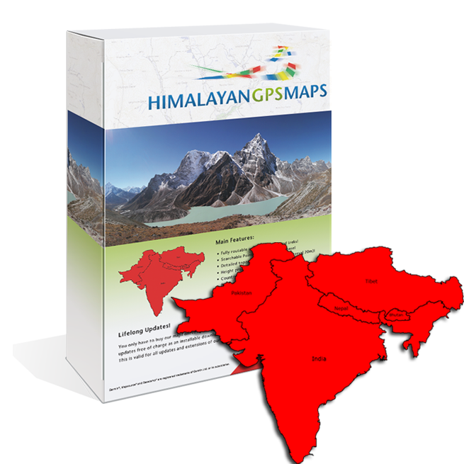
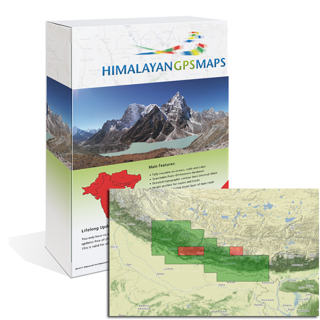
HimalayanTOPO
Himalaya Routable
The map covers the whole Himalayan region, including Nepal, Tibet, India, Pakistan, Bhutan, Sri Lanka.
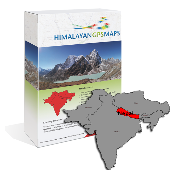
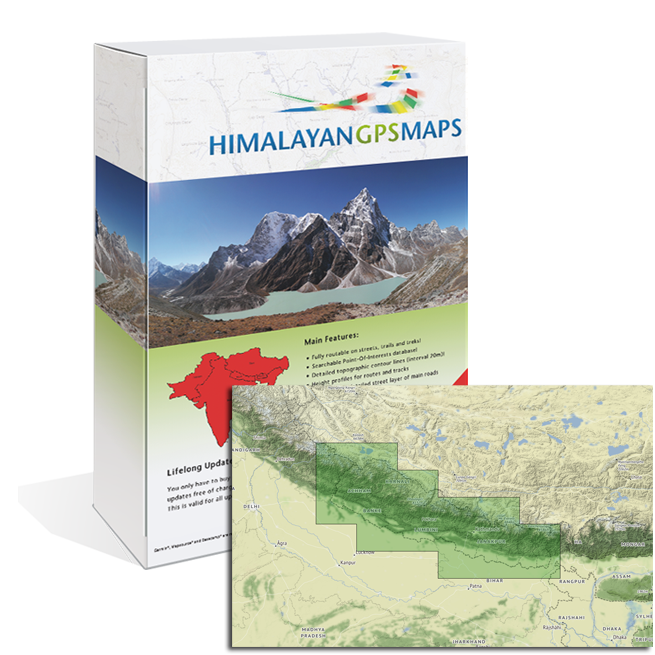
HimalayanTOPO
Nepal Routable
The map covers Nepal and some areas of India and Tibet near the Nepali border.
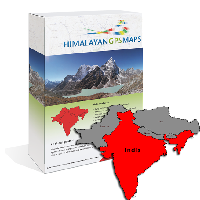
HimalayanTOPO
India Routable
The map convers India incl. Sikkim, Sri Lanka and some areas of Nepal, Tibet, Bhutan and Pakistan near the India border.
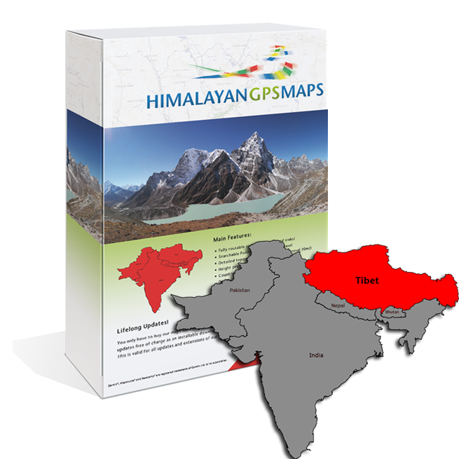
HimalayanTOPO
Tibet Routable
The map covers Tibet and some areas of India, Nepal and Bhutan near the tibetian border. South side of Mount Everest as far as down to Lukla is included.
Raster Maps
Raster maps are comparable to your existing paper maps – but in a digital format. Our raster maps are available in a wide range of formats, capable for Global Mapper®, QuoVadis®, Fugawi®, OziExplorer® and many others.
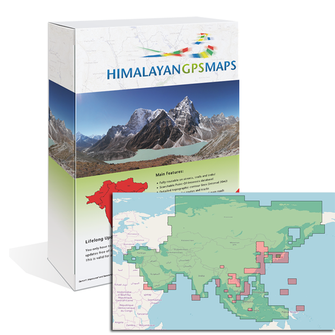
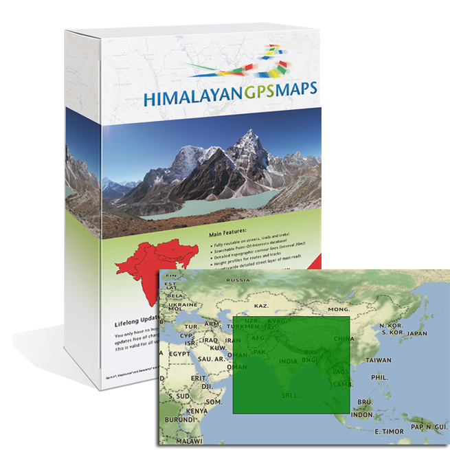
HimalayanTOPO
Asia Raster Soviet Military 500k
The paper maps of this seamless digital raster map were produced by the USSR military from around 1972 to 1997. The map covers whole asia continent.
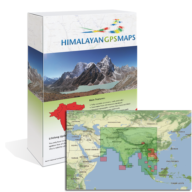
HimalayanTOPO
Himalaya Raster Soviet Mlitary 500k
The paper maps of this seamless digital raster map were produced by the USSR military from around 1972 to 1997. The map covers whole himalaya area.
HimalayanTOPO
Nepal Raster Soviet Military 200k
The paper maps of this seamless digital raster map were produced by the USSR military from around 1980 to 1990. The map covers whole Nepal area.
HimalayanTOPO
Nepal Raster US Military 250k
The paper maps of this seamless digital raster map were produced by the US Army Mapping Service (AMS) in 1957 and from around 1983 to 1988. The map convers whole Nepal area.
Digital Elevation Models
Digital Elevation Models are used to display 3D data in mapping software or to create own hill shading maps, vector contour lines etc. Our DEMs are available in a wide range of formats, capable for Global Mapper®, Quovadis®, Fugawi®, OziExplorer® and many others.
HimalayanDEM Himalaya
Our Digital Elevation Model of the whole Himalayan region is compatible with all major GIS software products like QuoVadis® or Global Mapper®. It covers the complete Himalayan region including Nepal, India, Sikkim, Pakistan, Bhutan and Tibet.