HimalayanTOPO Digital Elevation Model
Gallery:

Description
Our Digital Elevation Model of the whole Himalayan region is compatible with all major GIS software products like QuoVadis® or Global Mapper®. It covers the complete Himalayan region including Nepal, India, Sikkim, Pakistan, Bhutan and Tibet.
The DEM data can be used to view 3D data, enhance existing 2D maps with elevation data, create nice maps with hill shading etc. (functionality depends on your GPS software).
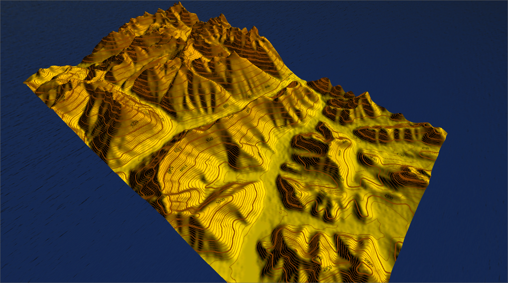
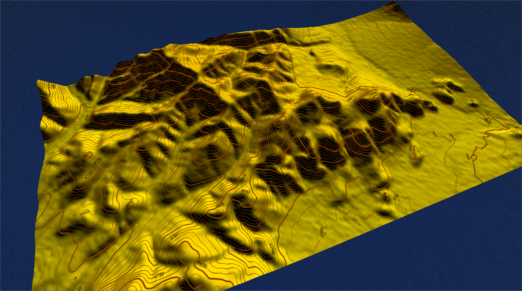
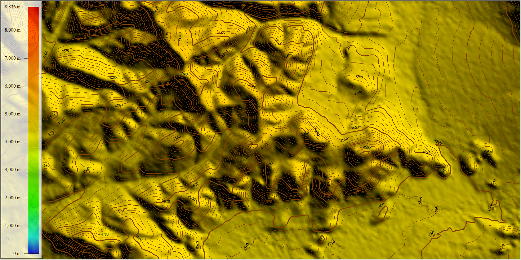
Furthermore we inlcude a detailed vector data layer of contour lines at an interval of 20 meters! The contour lines were created from the DEM data at a very high level of detail. You can use this layer as an overlay for existing raster maps or to create own vector maps from sources like OpenStreetMap or similar. The data can be used in Globalmapper® only (for other GPS software the data has to be converted before usage).
The mapset includes (seamless):
- Detailed Digital Elevation Model in 3 arc seconds (Himalaya region)
- Digital Elevation Model in 30 arc seconds incl. bathymetric data (worldwide)
- Vector Contourlines at an interval of 20m (Himalaya region)
Compatibility
- QuoVadis®
- GlobalMapper®
- OziExplorer®
- Many more with GeoTiff®- and HGT®-Support
Data format
The package contains the seamless raster map as well as the Digital Elevation Model. The following file formats are included:
- DEM: Global Mapper® Grid (.gmg format), best for Global Mapper® and QuoVadis®, GeoTIFF® (.tiff format), SRTM3 (.hgt format)
- VECTOR: Global Mapper® Package (.gmp format)
Map Coverage
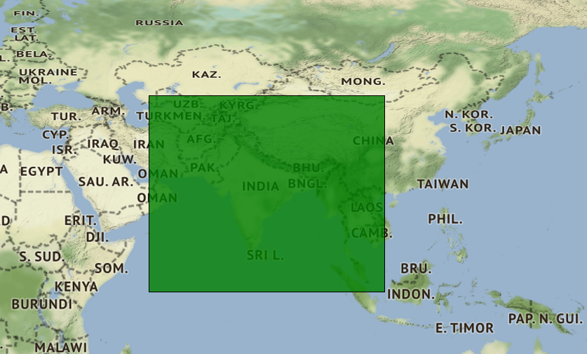
The DEM and vector layer with contour lines at an intervall of 20m cover the whole Himalaya region. Exact coverage is:
Upper left corner longitude: 54° 12′ 12.0094″ E
Upper left corner latitude: 43° 54′ 39.1155″ N
Lower right corner longitude: 107° 38′ 09.0094″ E
Lower right corner latitude: 0° 41′ 32.8845″
Datasource
The basis of our Digital Elevation Model is the 3 arc seconds data set collected by the 2000 Shuttle Radar Topography mission (NASA/USGS SRTM3).
This data was enhanced and corrected by Jonathan de Ferranti from Viewfinder Panoramas with other topographic sources like raster and paper maps. Therefore the data from Viewfinder Panoramas is the best DEM data available for the Himalaya region.
The data from Viewfinder Panoramas was slighty corrected and enhanced by HimalayanGPSMaps in 2016.
“The cartographic production produced by the USSR during the Cold War period is immense, encompassing all corners of the globe. These topographic maps have a quality and a detail that surprises, especially as some of them are so remote and difficult to access for the technology of the time. Today, we can find countries where the best cartographic base is even Soviet maps.“
https://www.geamap.com/en/soviet